Asarlık Tepeler Tabiat Anıtı
About Asarlık Tepeler Tabiat Anıtı
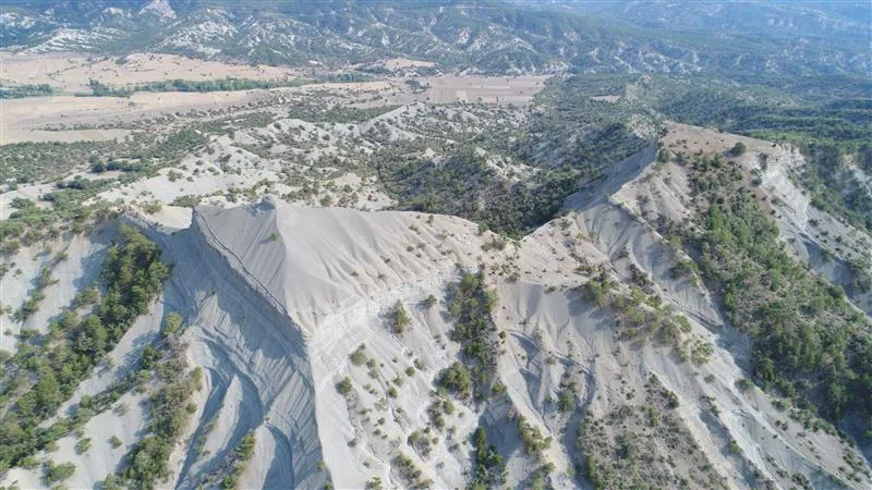
Asarlık Tepeler Tabiat Anıtı (Asarlık Hills Natural Monument) is a 52-hectare protected area in Nallıhan district, at the Asarlık locality between the villages of Danişment and Oklalar. It was declared a natural monument on 22 August 1994. The hills, at about 1,091 metres, are rare examples of cuesta landforms, created as clay layers of differing hardness wore away at different rates. The regional nature-conservation directorate describes the area as well suited to educational and scientific study of rock layers and landforms. The site is small and its habitats are limited, so its flora is not especially rich, but surveys have recorded 141 plant taxa from 37 families, 11 of them endemic to Turkey. One of these, Oxytropis argyroleuca (ala gaga geveni), is listed as critically endangered and is otherwise found only on Sarıçalı Dağı to the west, while Melilotus bicolor (hercai yonca) is listed as vulnerable. Black pine, Greek juniper and prickly juniper also grow here. Recorded animals include toads, tortoises, green lizards, nose-horned vipers, hedgehogs, Anatolian ground squirrels, wild boar, weasels, sparrowhawks, long-legged buzzards, kestrels, chaffinches and robins. Because of its protected status there are no buildings or visitor facilities; the only activity on offer is a walking route, and scientific research needs permission from the DKMP 9th Regional Directorate. The monument is reached by private vehicle, about 157 km from central Ankara and 21 km from Nallıhan town, via the Nallıhan-Bolu (D140) road and the Seben road, which branches off near Dereköy. Danişment is the nearest settlement, about 1.5 km away as the crow flies.
Images
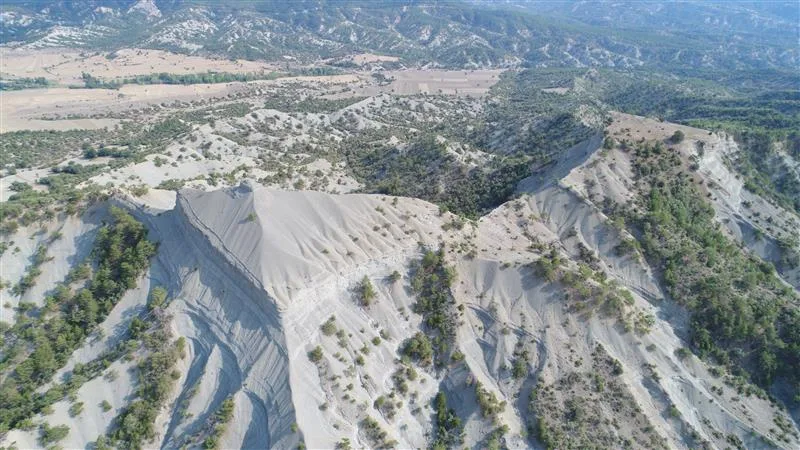
Image 1 of 1
Official sources
- DKMP 9th Regional Directorate - Ankara Tabiat AnitlariChecked 2026-11-10
- DKMP Doga Turizmi - Asarlik Tepeler Tabiat AnitiChecked 2026-11-10
Pass it on
Share this page
Send this Ankara guide to someone who will find it useful.